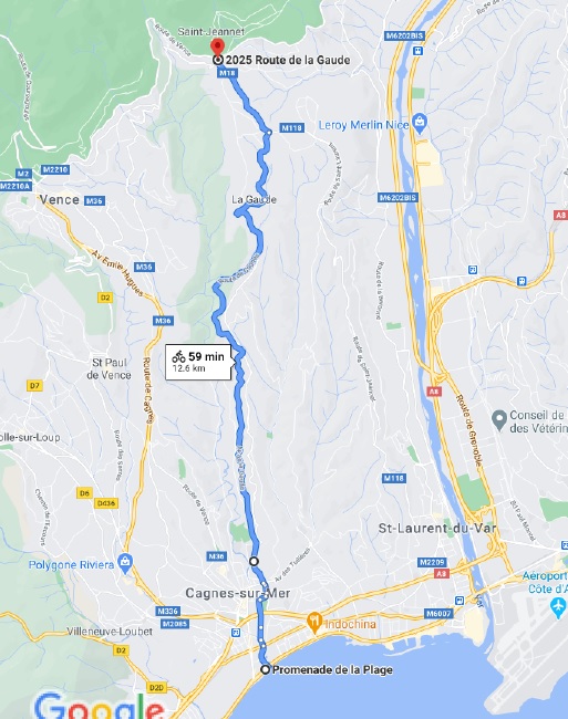
Description
12.6km (8 miles), 321m (1053 feet) climbing. Good Scenic route and apart from the centre of Cagnes there is not much traffic. For a good part of the route there are cycles lanes. Spectacular view of the “Baou de St Jeannet”. One of the better routes to go towards Vence.
Directions
1. Head northeast on Prom. de la Plage/M6098 68 m
2. Make a U-turn 15 m
3. Turn right onto Allée des Bouleaux 400 m
4. Continue onto Rue Bir Hakeim 110 m
5. Slight right onto Allée des Tilleuls 200 m
6. Continue straight to stay on Allée des Tilleuls 450 m
7. Turn right toward Avenue Georges Pompidou 14 m
8. Slight left onto Avenue Georges Pompidou 110 m
9. Keep left to stay on Avenue Georges Pompidou 60 m
10. Continue onto Avenue Cyrille Besset/M36 150 m
11. Slight left to stay on Avenue Cyrille Besset/M36 40 m
12. Continue onto Avenue de la Gaude/M18. Continue to follow M18 8.1 km
13. At the roundabout, take the 2nd exit onto Route. de Cagnes/M18 1.3 km
14. At the roundabout, take the 3rd exit onto Route de Saint-Jeannet/M18 heading to St Jeannet/Vence. Go through 1 roundabout 2025 Route de la Gaude 1.6 km
