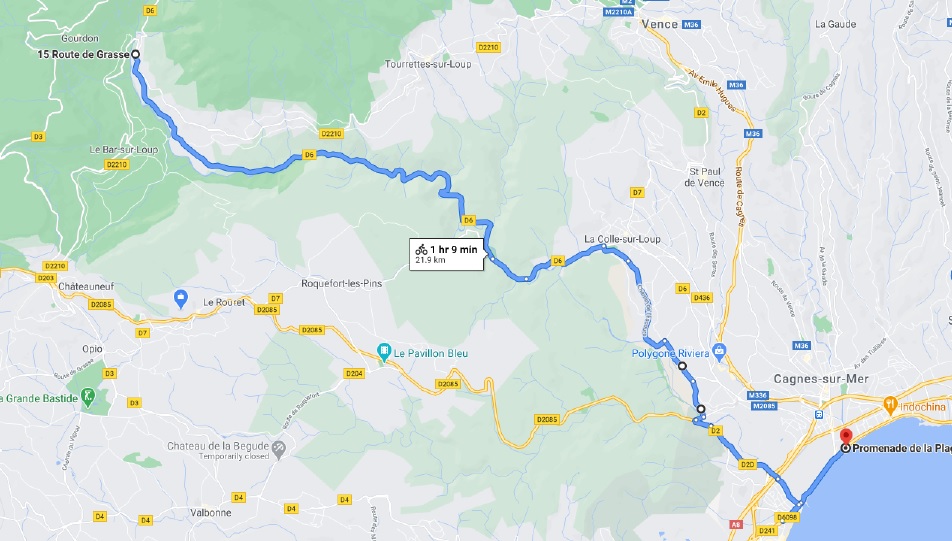
Description
21.9km (13.6 miles), 46m (150 feet) climbing, 247m (810 feet) descent. Descends the Gorge du Loup which is a narrow gorge with cliffs on both sides. There is a separate cycle-way when it get busy at Villeneuve Loubet.
Directions
1. Head southwest on Route de la Colle/D6. Continue to follow D6 10.2 km
2. Turn left onto Route de la Colle-sur-Loup/D7. Continue to follow Route de la Colle-sur-Loup. 750 m
3. Continue onto Route du Pont de Pierre/D6./ Continue to follow D6 1.7 km
4. Turn right onto Boulevard Alex Roubert Go through 1 roundabout 600 m
5. Continue onto Chemin de l'Escours 2.0 km
6. Turn right onto Avenue Antony Fabre 900 m
7. Continue straight onto Avenue de la GrangeRimade/D2. Continue to follow D2. 500 m
8. Turn right onto Passerelle Saint-Georges Restricted usage road 6 Passerelle Saint-Georges 7 m
9. Head southwest on Passerelle Saint-Georges Partial restricted usage road and takde the footbridge 245 m
10. Turn left toward Avenue des Plans/D2 160 m
11. Turn left onto the cycleway under the bridge 180 m
12. Turn left onto the cycleway next to the road and follow it for 1.7 km and under the motorway.
13. Turn left onto Avenue du Loup 650 m
14. Turn right onto Boulevard des Italiens/Route duBord de Mer/D6098 400 m
